Lyon
The Trion siphon
Once across the Sainte-Foy-lès-Lyon plateau, the Aqueduct has to cross a final declivity, the col de Trion, using the siphon of this name. It starts with a collecting reservoir still visible in the fort Saint-Irénée, crosses the col de Trion, and ends at a now-vanished receiving reservoir at the start of rue Roger-Radisson..
The piers of the rue Radisson
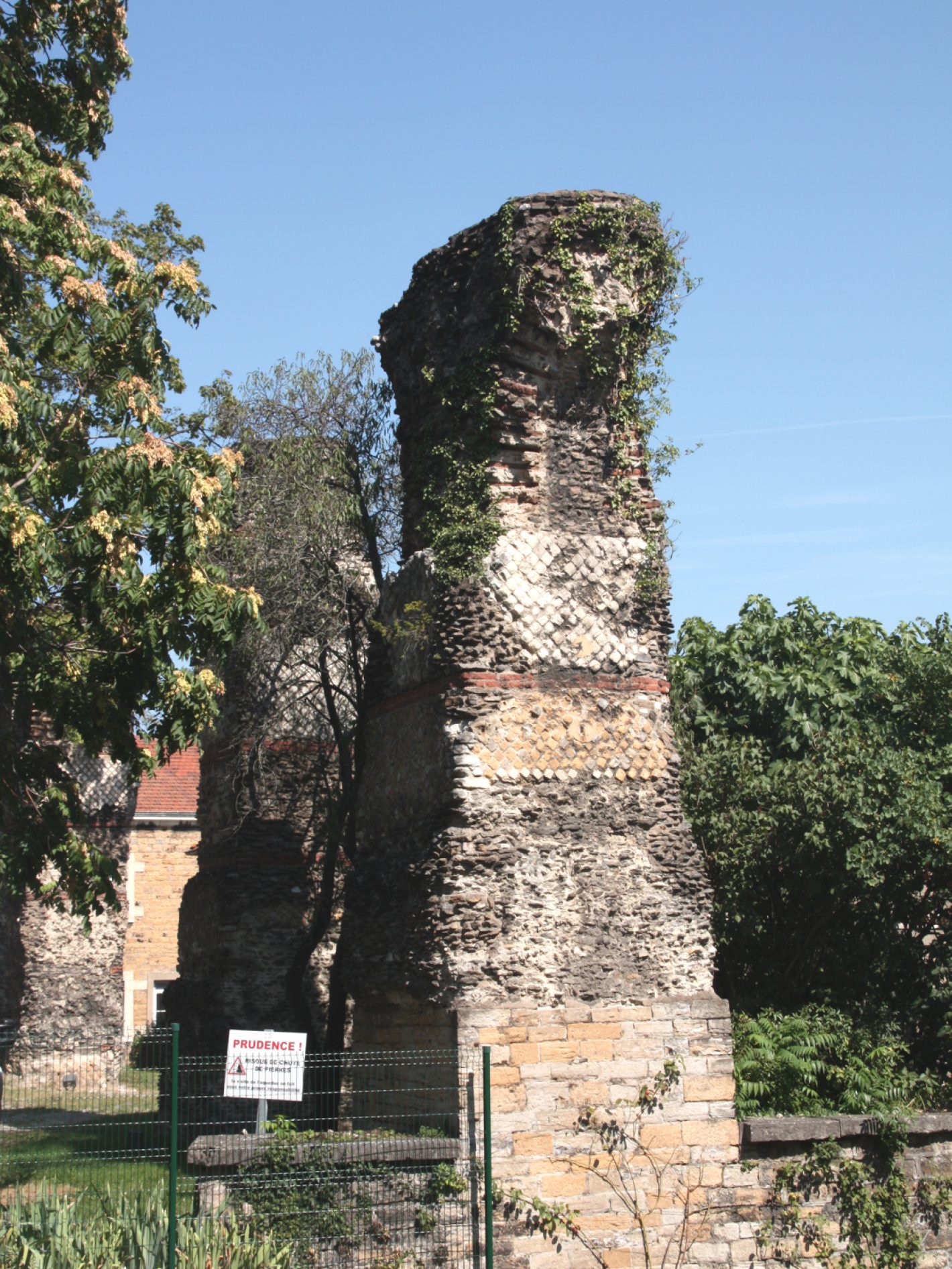
At the end of the Aqueduct, the remains of a series of piers are to be seen on both sides of the rue Radisson (Lyon 5th district). Appearing more or less accurately on numerous old plans, they are considered a valuable testimony to Lyon’s ancient past.
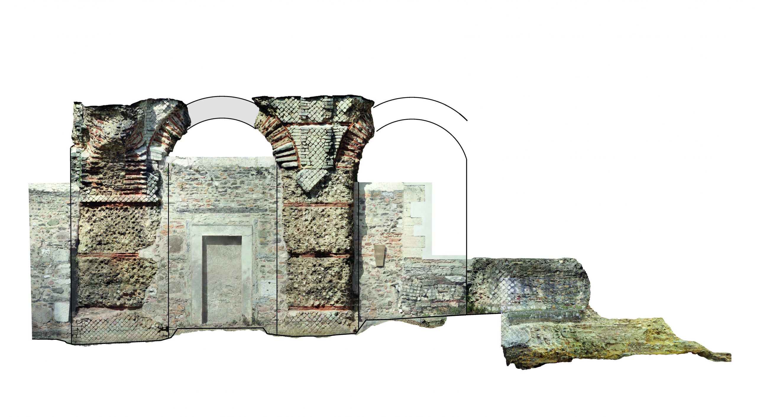
An 18th century plan and elevation of this site by G-M Delorme shows the still-surviving receiving reservoir slightly downhill from the piers, of which seven are still standing. Comparison between these drawings and the visible remains easily enables three vanished piers to be reinstated. The construction of new fortifications in the 19th century led to demolition of the receiving reservoir and the pier on which it stood.
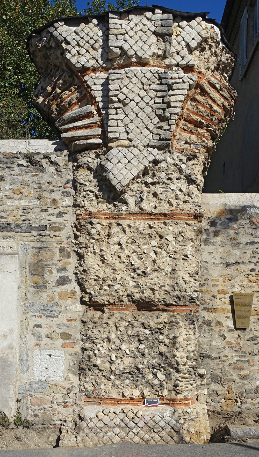
With the exception of one pier “liberated” in 1958, the other visible ones are more or less built into constructions of the 18th and 19th centuries (buildings or enclosure walls). They have been on the list of Historic Monuments since 1964. Exposed to the weather, the piers on the North of the street, whose tops were in the open air; were fitted about 15 years ago with a protective slate covering. Changes in the ground level mean that the three most westerly piers have their foundations very much exposed.
The piers of the rue Radisson enabled the water of the Aqueduct to reach the highest point of the ancient city (about 300m General Levelling) and potentially serve the Fourvière and La Sarra plateaux.
They are also the only piers within the confines of Lugdunum and almost certainly had to take account of pre-existing structures such as the Aquitaine Road and the southern extremity of the circus. These constraints may explain the sudden dog-leg in the Aqueduct, crossing from one side of the road to the other. Examination of the piers on the South side raises other archaeological questions, notably concerning the ancient ground level which changes dramatically between one pier and another.
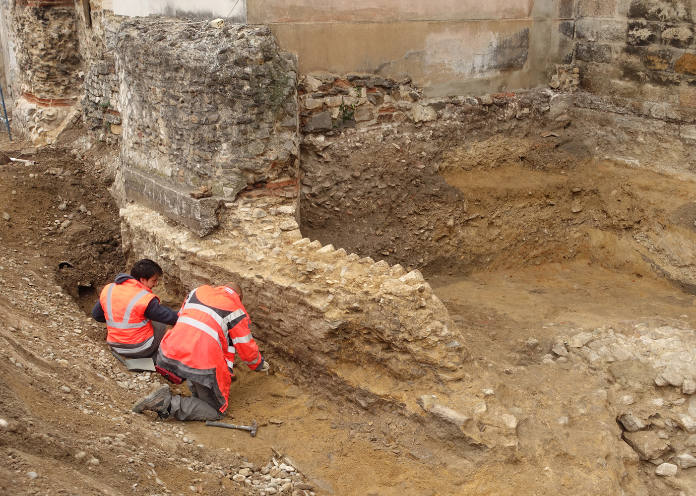
The last pier to the East drawn by G-M Delorme was largely amputated and incorporated into a house shortly after the date of his plan. He represented a pier turning at 90° to the South, suggesting a further deviation in the course of the Aqueduct; but there is no archaeological evidence for the direction in which it might have been heading. An operation of preventive archaeology carried out urgently by the Lyon archaeological service in 2018, provided the opportunity to examine this strange pier. The study was unable to confirm Delorme’s interpretation of the elevation of the pier (notably damaged during the installation of pipelines at the end of the 1960s) but did on the other hand reveal something totally unexpected about the foundations. Thus, as an integral part of the original construction; a small wall heads off from the base of the pier in a north-easterly direction. This discovery asks more questions than it answers and, while not changing the presumed heading of the Aqueduct, it does suggest the possibility of partially buried structures at the base of this last known pier.


Archaeological digs undertaken at Lugdunum seem to confirm that the Aqueduct terminated on Fourvière.
Several cisterns have been located which seem to be connected to the Aqueduct. Ongoing excavations will perhaps give a better understanding of its point of arrival on the hill.